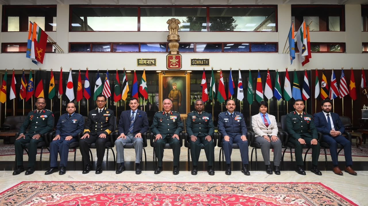
Wellington (Tamil Nadu), July 20: In a significant step towards enhancing future military planning and intelligence capabilities, the Defence Services Staff College (DSSC), Wellington, organised a Geo-spatial Intelligence Capsule for officers of the 82nd Staff Course on July 20, 2026.
The specialised programme focused on the growing role of Imagery Intelligence (IMINT), Geo-spatial Intelligence (GEOINT), Open-Source Intelligence (OSINT) and Artificial Intelligence (AI) in modern warfare, with the aim of equipping future military leaders with cutting-edge knowledge for multi-domain operations.
Focus on Information Superiority
The capsule showcased India’s intelligence architecture and advanced geo-spatial imaging capabilities, demonstrating how multiple intelligence sources can be integrated to build a comprehensive operational picture.
Officials highlighted that accurate and timely geo-spatial intelligence plays a crucial role in:
- Mission planning.
- Battlefield surveillance.
- Target identification.
- Border monitoring.
- Disaster response.
- Strategic decision-making.
The programme emphasized that information superiority has become a decisive factor in contemporary military operations.
Experts Share Global Perspectives
The event featured lectures by eminent experts, including:
- Air Vice Marshal D.V. Khot (Retd)
- Dr. Manan Suri, IIT Delhi
- Representatives from Defence Image Processing and Analysis Centre (DIPAC)
- Representatives from the Military Intelligence Training School (MINTSD)
The speakers shared insights into emerging global trends in geo-spatial intelligence and the evolving nature of intelligence-led warfare.
Key Areas Covered
The capsule covered a wide range of topics, including:
- Global developments in Geo-spatial Intelligence.
- Future trends in military intelligence.
- Open-Source Intelligence (OSINT).
- India’s defence geo-spatial capabilities.
- Role of the civil defence industry.
- Integration of Artificial Intelligence as a force multiplier.
- Advanced imagery analysis and surveillance technologies.
Experts discussed how AI-driven analytics, satellite imagery, drones and digital intelligence are transforming military operations across land, air, sea, cyber and space domains.
AI Emerging as Force Multiplier
A major focus of the discussions was the growing use of Artificial Intelligence in defence.
Officials highlighted that AI can significantly improve:
- Intelligence processing.
- Threat detection.
- Predictive analysis.
- Decision support systems.
- Battlefield awareness.
- Real-time operational planning.
The integration of AI with geo-spatial intelligence is expected to enhance the speed and accuracy of military decision-making.
Preparing Future Military Leaders
The Geo-spatial Intelligence Capsule forms part of the Defence Services Staff College’s efforts to expose officers to emerging technologies and evolving operational concepts.
With modern conflicts increasingly driven by data, satellite imagery, drones and network-centric operations, the programme aimed to prepare future commanders to effectively employ advanced intelligence tools for mission success.
The initiative reflects the Indian Armed Forces’ continued emphasis on technological innovation and integrated intelligence capabilities to strengthen operational readiness and maintain information superiority in an increasingly complex security environment.